Plant Census: the foundation for integrated technical management

With Geomap, you can digitize every system: location, coding, technical data, documentation, and maintenance status.
Comprehensive and reliable mapping, ready to improve safety, traceability, and intervention planning.

Servizio di rilievo e censimento impianti Geomap

For over 25 years, we have supported .

From the census to the digital system, in three operational phases

Geomap rilievo e censimento

Technical inspection and data collection

During the technical inspection, we survey each system, collecting physical, functional, and documentary data: type, location, photos, state of repair, classification code, serial numbers, power ratings, diagrams, manuals, and more.
Each system is uniquely identified, geolocated on a plan/map, and, if applicable, labeled with a QR code or RFID to ensure traceability.
The goal is to build a reliable, comprehensive, and immediately usable database.

Digitization and construction of personal data sheets

The data collected during the inspection is processed to create comprehensive and structured system records.
Each system is described using personal, technical, regulatory, and maintenance fields, with the option to attach photographs, technical documentation, certifications, system logbooks, and maintenance history.
The records are designed to be accessible and updated in real time, from a desktop or mobile device, and to provide an integrated view of the system assets, useful to technicians, maintenance personnel, and management.
Geomap Rilievo e censimento anagrafiche

Digitization and construction of personal data sheets

The data collected during the inspection is processed to create comprehensive and structured system records.
Each system is described using personal, technical, regulatory, and maintenance fields, with the option to attach photographs, technical documentation, certifications, system logbooks, and maintenance history.
The records are designed to be accessible and updated in real time, from a desktop or mobile device, and to provide an integrated view of the system assets, useful to technicians, maintenance personnel, and management.
Geomap censimento e importazione nel sistema informativo software Facility Management

Import into the information system

Once validated, all plant records are uploaded to the Geomap information system or, upon request, exported for integration into other management platforms already in use.
The plant assets thus become navigable and manageable with planimetric support, queryable, updatable, and ready to feed maintenance, planning, audit, and reporting processes.
In just a few days, you go from fragmented or non-existent data to a complete, reliable, and operational system.

Geomap is certified according to the UNI EN ISO 9001:2015 standard for the provision of:

  • Topographic surveys
  • 3D laser scanner surveys
  • LiDAR aerial photogrammetric surveys with drones
  • Technical registry activities
Certificazione Iso 9001 Geomap
Iso 45001 geomap
Certificazione Pas 24000 geomap
Documented quality, traceable processes, and results that consistently meet expectations, even in the most complex projects.
Rely on a certified, recognized, and excellence-oriented partner.

Still have questions about the Plant Census or want to know if it's right for your project?

Why choose Geomap's Plant Census?

Creation of a technical database, immediately usable for management and planning.

Each system has a complete data sheet, which can be consulted at any time and easily updated.

All the collected information can be imported into the information system without manual steps or Excel spreadsheets.

Related services

Inventario cespiti e riconciliazione contabile Geomap

Asset inventory and accounting reconciliation

Give coherence and value to your business assets

Geomap rilievo laser scanner 3d digital twin

3D Laser Survey and Digital Twin

Create the Digital Twin of each real estate asset to view, understand and manage

Geomap Aerofotogrammetria e rilievo LiDAR con drone

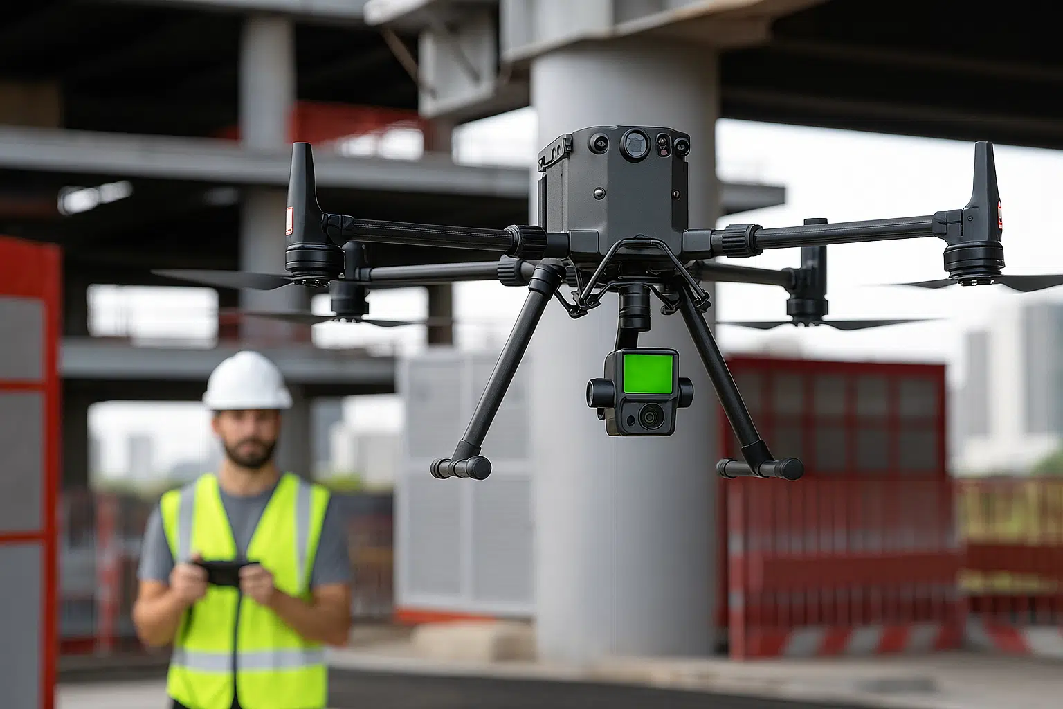
Lidar survey with drone

Map large areas in high definition and with maximum precision

servizio di Scan to Bim di Geomap

Scan to BIM

We convert laser surveys into BIM models for efficient design and management.

SOFTWARE CMMS/IWMS LEADER IN ITALY

Easy to use. Immediate impact.

With Geomap’s Facility Management System you can optimally manage the maintenance and systems of any real estate asset.
With Geomap’s Asset Management System you have complete control of your company’s assets and end-to-end life cycle.
Geomap’s Urban Facility Management is the powerful tool for managing urban land, roads and lighting systems.

Frequently asked questions about the Plant Census service

Geomap's service covers all major technological systems in residential, industrial, educational, healthcare, and office buildings.
We survey electrical, heating, plumbing, air conditioning, ventilation, fire prevention, elevator, automation, security, and data network systems.
The survey may also include special systems, fixed machinery, panels, peripheral components, and subsystems, depending on the site's technical structure.

During the census, we collect and record physical information (location, dimensions, visible components), technical information (power, capacity, serial number, brand, model), functional information (operational status, intended use, critical issues), and documentary information (manuals, booklets, wiring diagrams, certifications, photographs).
Each system is coded, geolocated, and described in a structured digital file, which can also be consulted on a floor plan.

Yes. In addition to data collection, we can label each system with a unique code, using QR codes or RFID tags.
This allows technicians and maintenance personnel to quickly identify the system in the field, view its complete datasheet, and update information directly via the app.
The labels are durable, scalable, and compatible with standard readers or smartphones.

Yes. The management system allows dynamic updates, either independently or with Geomap support.
Maintenance personnel, technicians, and managers can access system datasheets, modify data, upload new documents, or report changes.
Everything is tracked, with a history of changes and visibility of the system lifecycle.

Times vary based on the number of systems, their complexity, and the availability of plans and documentation.
At the end of the inspection, we always provide a detailed time estimate, broken down by location, building, and system category, with a clear and clearly defined timeline.

Yes, it's designed for this very purpose. In many cases, systems are already operational but not properly registered: there's no unique coding, the data is incomplete, and the documents are paper-based or scattered.
Our census allows us to build a reliable and verified database, even for older or undocumented systems, so they can be managed with modern and traceable logic.

Yes. In many cases, we recommend an integrated approach.
We use photogrammetric sensors for visual and planimetric aspects and LiDAR sensors for altimetric and structural aspects (e.g., mapping under vegetation or uneven surfaces).
This combination ensures complete and complementary data, ideal for complex GIS, BIM, or landscaping projects.

Yes. The collected data is structured according to technical and regulatory criteria, useful for preparing the Plant Register, Maintenance Plans, and technical documentation for MEPA tenders or Global Service contracts.
With the Geomap inventory, you can build a solid information base that can be used with suppliers, regulatory bodies, certification bodies, or during audits.

Contact us today

Book a free consultation with one of our experts. In just a few minutes, you’ll understand the timeframes, costs, and results you can achieve with our Plant Survey service.