The complete solution for Facility & Asset Management​

Italian suite of integrated software and services to effectively manage properties, systems and assets

For over 25 years, we have supported .

SOFTWARE CMMS/IWMS LEADER IN ITALY

Easy to use. Immediate impact.

With Geomap’s Facility Management System you can optimally manage the maintenance and systems of any real estate asset.
With Geomap’s Asset Management System you have complete control of your company’s assets and end-to-end life cycle.
Geomap’s Urban Facility Management is the powerful tool for managing urban land, roads and lighting systems.

With Geomap at your side, you manage the future of your real estate assets

Data acquisition services

Transform data from a cost center to a value creator with a suite of services designed to eliminate confusion and increase control.

Using 3D laser scanning technology, we create a digital twin of the building. This allows you to visualize, analyze, and plan interventions more efficiently, supporting technical and strategic decisions with reliable and constantly updated data.
With our plant inventory service, we collect and organize all the technical, functional, and documentary information about your plant assets. From physical location to coding, from construction features to planned interventions: all data is digitized and made immediately available in the system. This allows you to monitor, plan, and optimize maintenance activities effectively, transparently, and in compliance with regulations.
We conduct physical inventory of company assets and verify their consistency with the financial statements, addressing any discrepancies. Each asset is identified, labeled, and geolocated, with up-to-date data and complete documentation. The result? A solid, verifiable, and digitalized capital base to support audits, financial planning, and efficient asset management.
We use professional drones equipped with LiDAR sensors and high-resolution cameras to acquire three-dimensional data of land, buildings, and infrastructure. Aerial photogrammetry allows for accurate and georeferenced modeling even in hard-to-reach areas. The result is a survey with a very high point density, perfect for planning, topographical surveys, and cartographic updating.

Data modeling services

Shape your surveys with intelligent digital models, ready for design, maintenance and technical control

We convert laser surveys into BIM models for efficient design and management.
We generate detailed 2D CAD drawings to support design and documentation.

Sectors and applications

Geomap’s software and services can offer comprehensive lifecycle management of buildings and structures across all sectors.

Geomap Settore Facility Company Software e Servizi per le Facility Company che vogliono crescere

More control, less waste: manage properties and systems with digital precision

If you manage properties, systems, or services for third parties, you know how complex it is to keep everything under control. With Geomap, you have a single point of access for technical surveys, inventory, digital assets, and maintenance activities.
Our tools help you better plan interventions, reduce response times, and meet contractual SLAs and KPIs. This way, you can offer your customers a more efficient, traceable, and always regulatory-compliant service.
Geomap settore Real Estate: Tutto il tuo patrimonio immobiliare sotto controllo: il software SaaS per il Real Estate

Enhance every asset, from surveying to documented technical management

If you work in the real estate sector, you know that having incomplete or outdated data can slow down every decision. With Geomap, you can count on precise surveys, up-to-date digital twins, and a platform that allows you to monitor the technical, documentation, and maintenance status of each property.
Minimize risks, enhance your assets, and better support sales, redevelopment, or rental management operations with reliable, ready-to-use data.
Geomap settore Industrial

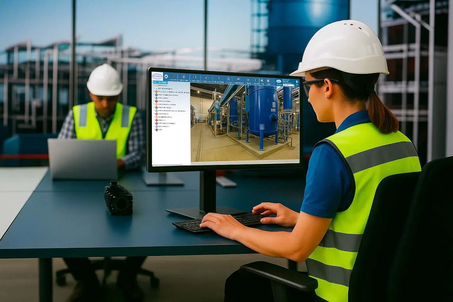
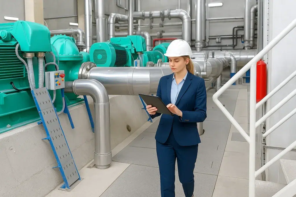
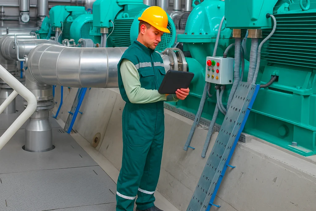
Technical and asset control for always operational and compliant plants

Managing industrial plants requires a comprehensive view and precise detail. With Geomap, you can inventory every asset, monitor system status, and manage deadlines and technical documentation from a single platform.
Our surveying, digitalization, and modeling services help you reduce downtime, improve maintenance, and ensure regulatory compliance. More reliable data, fewer unexpected events: your facility operates safely and continuously.
Geomap Settore Retail e Centri Commerciali

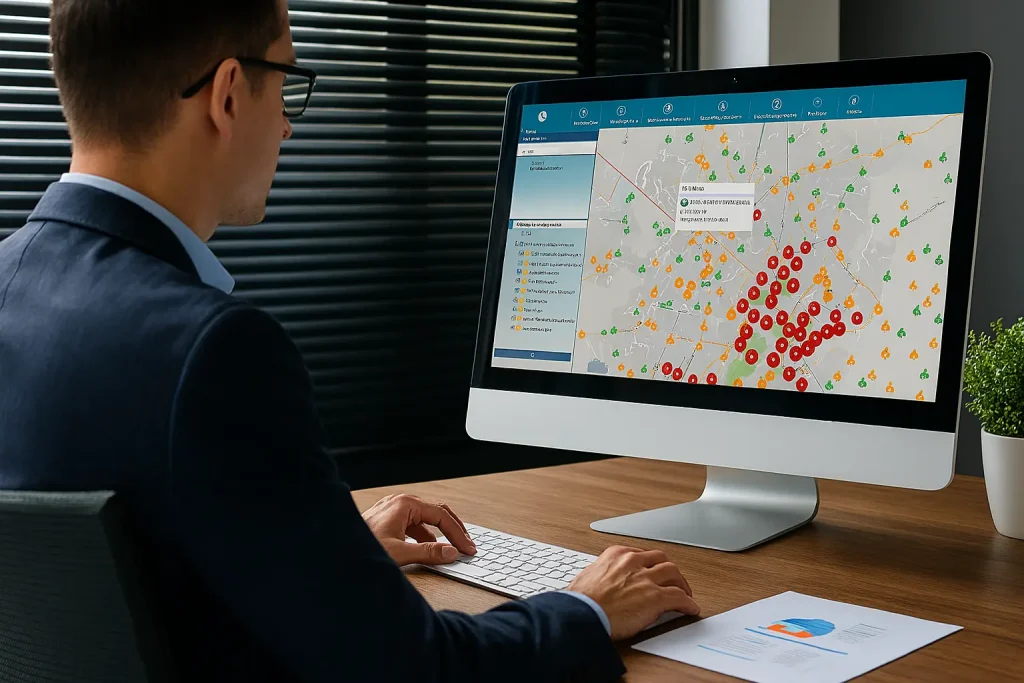
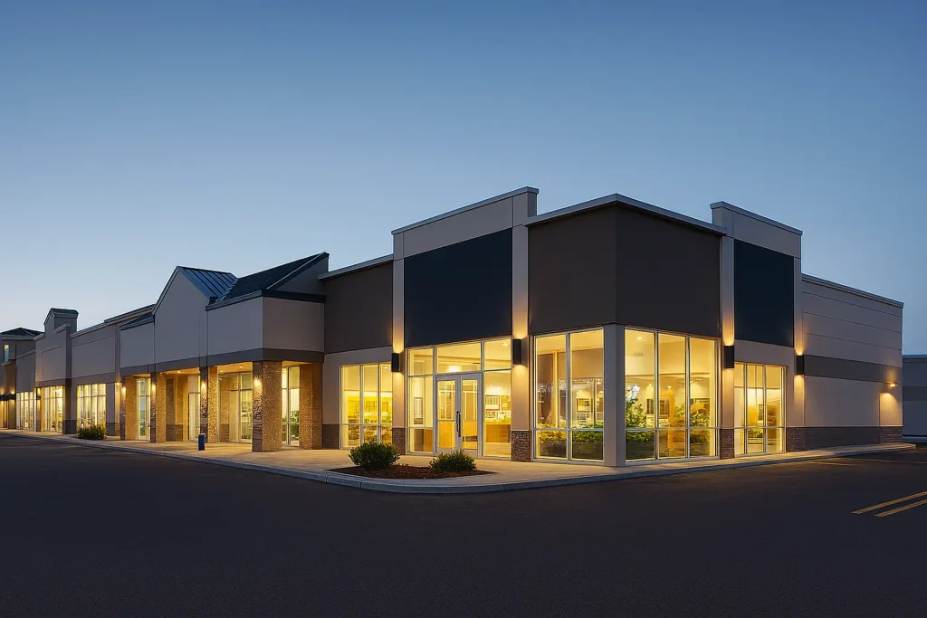
Centralized management for sales networks always under control

If you manage a network of stores or points of sale, you know how complex it is to keep track of systems, assets, layouts, and maintenance interventions. With Geomap, you have a unified view of your entire retail portfolio: digital surveys, updated inventories, tracked systems, and constantly monitored maintenance interventions.
Plan, verify, and intervene with reliable data, wherever you are. So you can focus on growing your business, confident that every space is efficient, compliant, and well-managed.
Geomap settore Hospital Innovazione patrimoniale per ospedali e aziende sanitarie

Efficiency, traceability and compliance for always-operating healthcare facilities

In hospitals, every system, environment, and equipment must be precisely monitored. With Geomap, you can digitize your real estate and plant assets, track maintenance activities, and keep technical documentation up-to-date.
Reduce risks, improve planning, and ensure operational continuity for your departments, in full compliance with health and safety regulations.
Public Amministration e Smart City Geomap. Servizi di Facility Management per la Pubblica Amministrazione

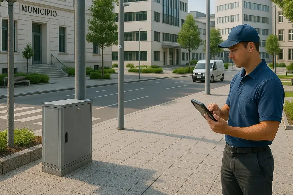
Digitize public assets and improve the technical management of properties

If you work in public administration, you know how important it is to have a clear, up-to-date, and documented overview of the properties and systems you manage. Geomap helps you digitize public assets, simplify censuses, track maintenance, and ensure regulatory compliance (CAM, fire prevention, safety).
Reduce waste, facilitate audits, and operate with greater transparency towards citizens, regulatory bodies, and other entities.
H-Bim Geomap

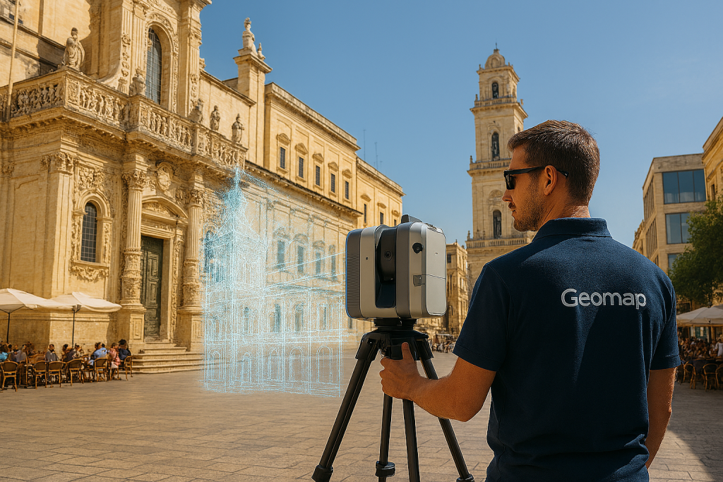
Technology at the service of cultural heritage conservation

Protecting cultural heritage requires precise and non-invasive tools. With Geomap, you can perform high-definition 3D laser and photogrammetric surveys, create digital twins of historic buildings, and model even the most complex geometries in BIM. Our services support restoration, structural monitoring, maintenance, and enhancement plans.
All data is documented, georeferenced, and ready for informed and traceable conservation interventions.

Contact us
today

Get started with a product presentation or schedule a consultation with an expert to see how your organization can benefit from Geomap software and services.