Scan to BIM: from point cloud to digital BIM model​

We transform 3D laser surveys into accurate, interoperable, and scalable BIM models. From survey to modeling, we deliver a structured digital asset, ideal for architectural design, facility management, costing, and technical maintenance.

scan to bim servizio geomap

For over 25 years, we have supported .

A traceable process, from survey to verified BIM model

Nuvola di punti Geomap

Import and validation of the point cloud

The process begins with the import and analysis of the point cloud generated by laser scanning.
In line with National Guidelines, we perform a geometric consistency and density check, identifying any blind spots, noise, or incompleteness.
We evaluate the type of modeling required and define the Level of Detail (LOD) and Level of Information (LOI) to be developed, based on the model’s purpose (design, management, archiving, computation, etc.).
This phase is essential to ensure the quality and adequacy of the initial data, upon which a reliable model can be built.

Architectural and plant BIM modeling

Based on the validated cloud, we build the BIM model with parametric objects consistent with the captured reality, developing architecture, systems, and structures in line with the requirements of the defined LOD.
The process follows the Guidelines’ criteria: objects are classified according to standard families, equipped with useful information attributes, and organized by logical and spatial environments.
At this stage, we also ensure proper tolerance management, alignment with real-world geometries, and traceability between the cloud and the model.
Geomap Modellazione BIM

Architectural and plant BIM modeling

Based on the validated cloud, we build the BIM model with parametric objects consistent with the captured reality, developing architecture, systems, and structures in line with the requirements of the defined LOD.
The process follows the Guidelines’ criteria: objects are classified according to standard families, equipped with useful information attributes, and organized by logical and spatial environments.
At this stage, we also ensure proper tolerance management, alignment with real-world geometries, and traceability between the cloud and the model.

Final verification, delivery and interoperability

Once modeled, the BIM undergoes a geometric and semantic verification process, in compliance with the project specifications and the open standards defined by buildingSMART.
We deliver the model in all required formats: RVT, IFC, etc., accompanied by a technical report on the modeling process and a LOD/LOI table.
The result is a robust, interoperable, and ready-to-use digital model, usable in BIM authoring environments, CDEs, management software, or facility management platforms.

Geomap is among the speakers of the Italian Scan to BIM Guidelines

We actively participated in the drafting of the National Scan to BIM Guidelines, the official document that defines criteria, workflows, and standards for correct BIM modeling based on laser scanning surveys.
This recognized technical contribution guarantees a compliant, up-to-date, and professional approach.
geomap linee guida nazionali scan to bim

Still have doubts or want to understand if Scan to BIM is right for your project?

We are partners of buildingSMART

Geomap is an active member of buildingSMART, the international organization driving the digital transformation of the built environment through open standards, interoperability, and continuous innovation.

Why choose Geomap's Scan to BIM service?

The model is built starting from verified laser surveys, following geometric and information criteria compliant with the National Scan to BIM Guidelines.

Each BIM object is parametric, classified, informed and ready to be used in the design, computational or management fields.

The end result is a reliable, interoperable digital model delivered in the standard formats required by designers, contracting authorities, and CDE platforms.

Related services

Geomap rilievo laser scanner 3d digital twin

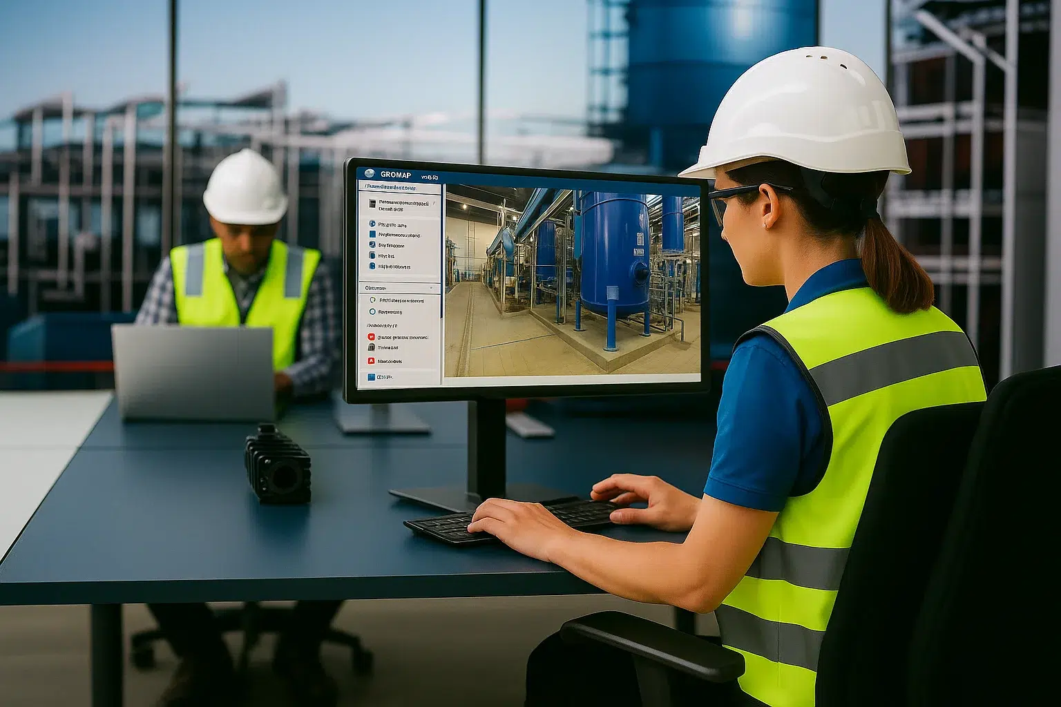
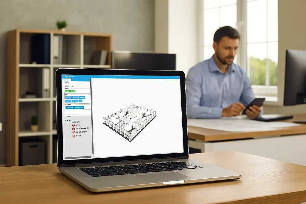
3D Laser Survey and Digital Twin

Create the Digital Twin of each real estate asset to view, understand and manage

Geomap Aerofotogrammetria e rilievo LiDAR con drone

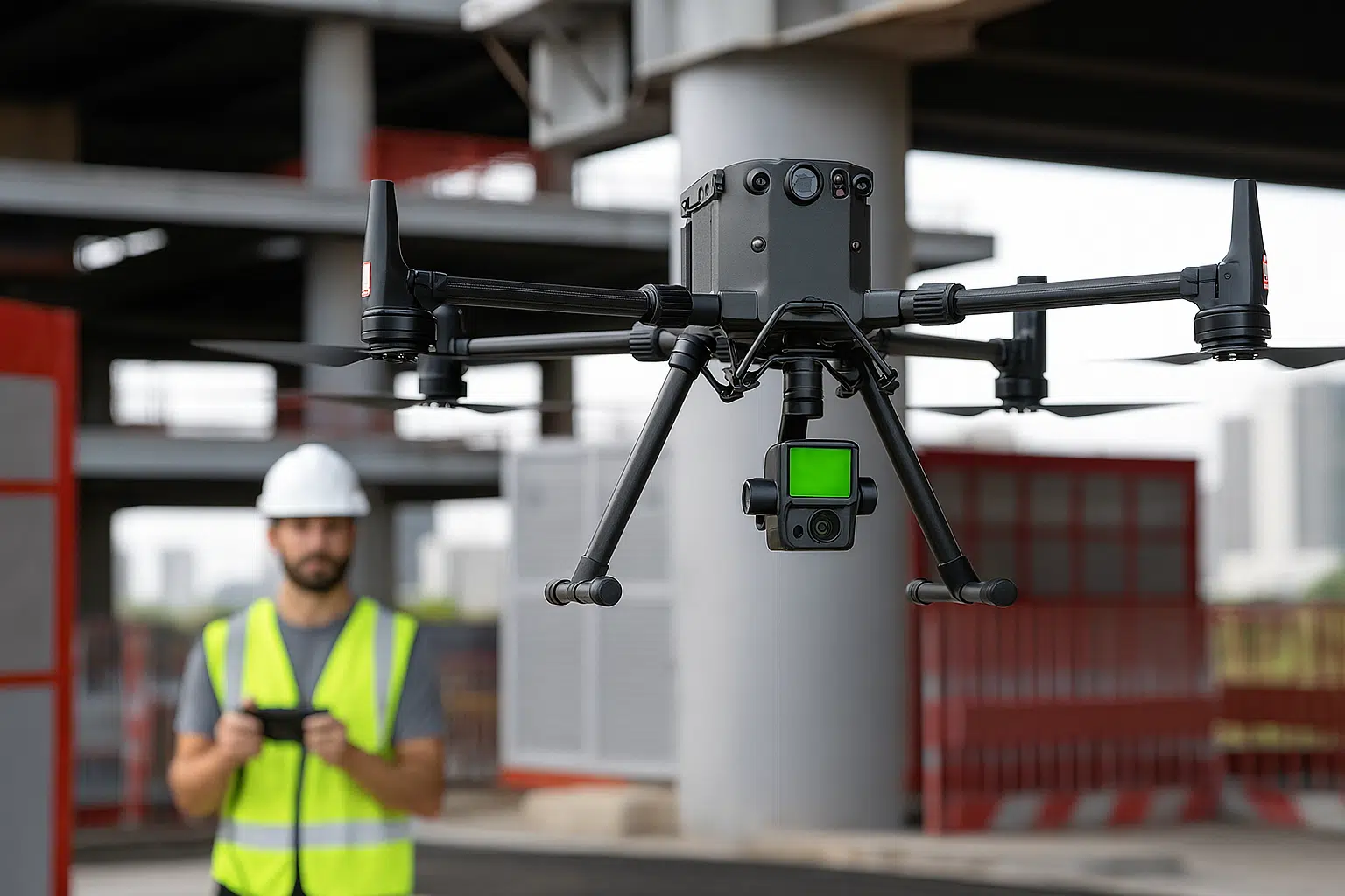
Lidar survey with drone

Map large areas in high definition and with maximum precision
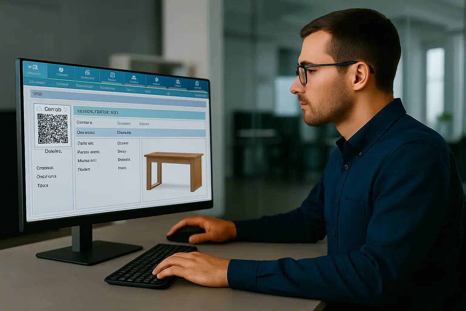
Servizio di rilievo e censimento impianti Geomap

Plant census

Transform any building, facility or urban area into a navigable and measurable digital model

Inventario cespiti e riconciliazione contabile Geomap

Asset inventory and accounting reconciliation

Give coherence and value to your business assets

SOFTWARE CMMS/IWMS LEADER IN ITALY

Easy to use. Immediate impact.

With Geomap’s Facility Management System you can optimally manage the maintenance and systems of any real estate asset.
With Geomap’s Asset Management System you have complete control of your company’s assets and end-to-end life cycle.
Geomap’s Urban Facility Management is the powerful tool for managing urban land, roads and lighting systems.

Frequently Asked Questions about Scan to BIM

A point cloud is a set of millions of spatial coordinates (XYZ) acquired from a 3D laser survey. It is raw geometric data, useful for measurements, inspections, and visualization, but is unstructured.
A BIM model, on the other hand, is a digital reconstruction made up of intelligent parametric objects, with information attributes, spatial relationships, and classifications.
Scan to BIM is the process that transforms a point cloud into an information model usable for design, maintenance, or management.

We develop models according to the levels of detail required by the client or project, in line with the UNI 11337 standard and the National Scan to BIM Guidelines.
We can produce models in LOD 200, 300, or higher, always specifying the associated Level of Geometry (LOG) and Level of Information (LOI).
Each model is accompanied by a documented and traceable LOD/LOG table.

Yes. The service can be provided starting from an existing point cloud, provided it has sufficient geometric accuracy and includes key information: density, coordinates, reference system, orthogonality, and resolution consistent with the required LOD.
We always perform a preliminary validation of the cloud to verify its suitability for modeling.

We use professional BIM authoring environments such as Autodesk Revit®, Graphisoft Archicad®, and cloud management support software (e.g., Recap, CloudCompare).
The final model can be exported in IFC 2x3 or IFC 4, 3D PDF, NWC/Navisworks, DWG, or Revit Native formats.
We follow the openBIM standards defined by buildingSMART International.

Yes. Each model can be produced in IFC format, according to the required specifications, with a consistent structure, correct classes, and clean geometries.
We test IFC quality with validation tools and ensure full interoperability with coordination, integrated design, and CDE environments.

We work on a wide range of buildings: historic complexes, schools, hospitals, offices, museums, industrial plants, infrastructure, and urban areas.
We have experience in protected contexts (cultural heritage), degraded buildings, or environments with high plant density, managing hybrid architectural and MEP (Mechanical, Electrical, Plumbing) modeling.

Times depend on the size and complexity of the building, the required LOD, and the quality of the cloud.
We always provide a personalized estimate following a preliminary analysis.

Yes. The model can be structured from the start to support technical and maintenance management.
In this case, plant master data, spatial relationships, logical coding, and technical attributes are inserted for management via CMMS software or BIM to FM platforms.
Upon request, we integrate the model directly into Geomap software for Facility and Asset Management.

Contact us today

Book a free consultation with one of our experts. In just a few minutes, you’ll understand the timeframes, costs, and results of Scan to BIM.