






Software for the management of urban areas and infrastructures

Integratedly manage your urban assets: public lighting, technology networks, roads, utilities, consumption, and maintenance. Geomap UFM is the most comprehensive and customizable GIS platform for Urban Facility Management.

geomap ufm gestione reti urbane e illuminazione stradale

End-to-End Solution for Urban Heritage Management

SaaS platform, accessible anywhere, without local infrastructure

The power of AI integrated into the software

Modularity, scalability and integration with existing systems

A single platform Accessible Scalable Traceable

All the features for a smart management of urban areas

Geomap UFM integrates everything you need to map, manage, maintain and optimize urban facilities, networks and infrastructures.

Cartografia Geomap UFM

The entire territory under control, on a cartographic basis

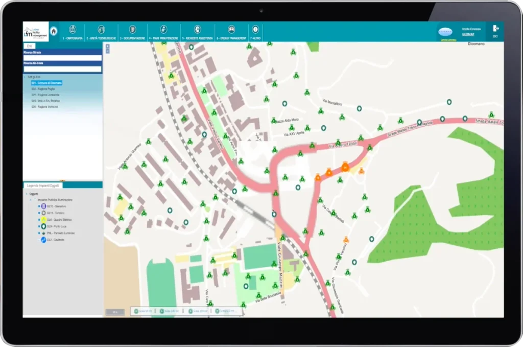
Every urban asset—plant, infrastructure, electrical panel, network, meter—is mapped on GIS and located with precise coordinates. It’s possible to navigate the territory, identify features, and visualize networks, routes, distributions, and spatial relationships in real time.

Complete and structured digital personal data sheets

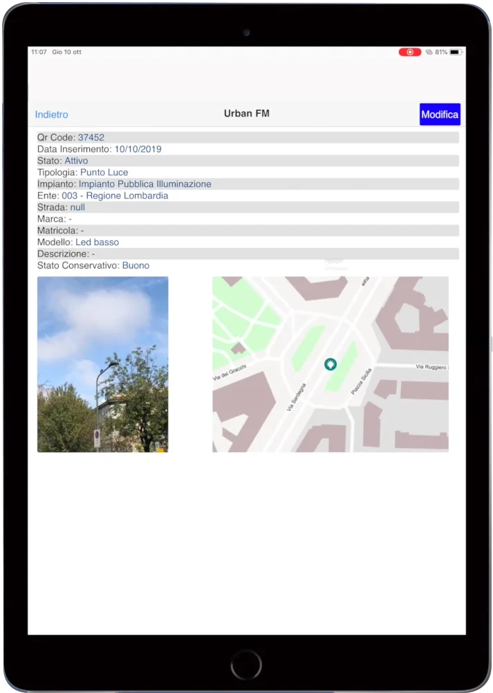
Each managed object is described by a customizable technical data sheet, which contains descriptive, technical, documentary, maintenance, and positional data. The information is organized hierarchically and can be linked to other assets, systems, or activities.
Anagrafica Geomap UFM

Complete and structured digital personal data sheets

Each managed object is described by a customizable technical data sheet, which contains descriptive, technical, documentary, maintenance, and positional data. The information is organized hierarchically and can be linked to other assets, systems, or activities.
Georeferenziazione Geomap UFM

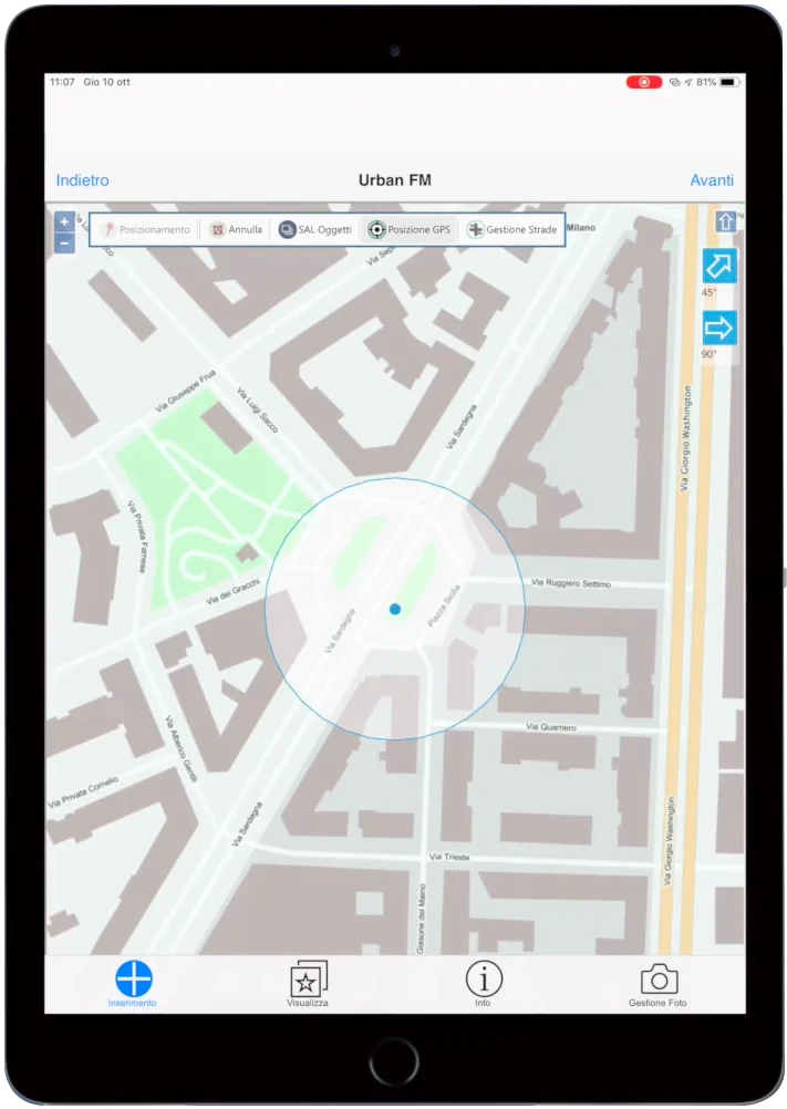
Indoor and outdoor georeferencing with QR or RFID

Assets can be physically labeled with QR codes or RFID tags and located both on an internal floor plan (for buildings and complex systems) and on a city map. The mobile web app allows technicians and operators to survey, update, and navigate directly in the field.
Gestione manutenzioni Geomap UFM

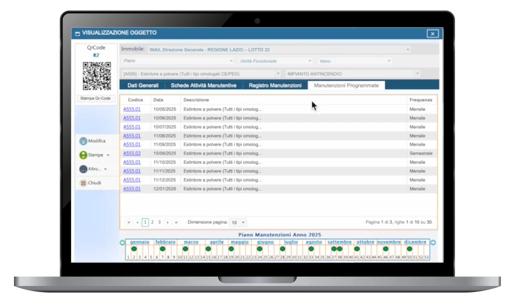
Scheduled, tracked and optimised maintenance

Geomap UFM intelligently manages the schedule of routine and preventative maintenance: each activity is planned, reported, and monitored over time, with dynamic assignment, intervention history, and automatic notifications. Extraordinary activities and tickets are integrated into the system and managed in operational continuity.

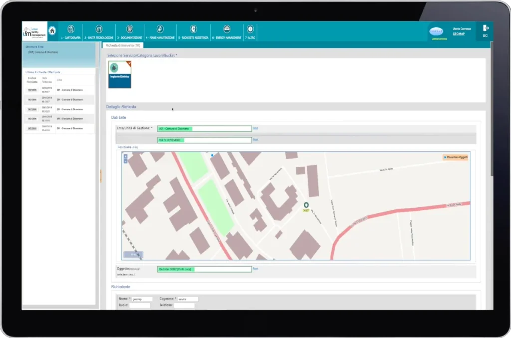
Requests, tickets and SLAs always under control

Requests for intervention can be entered by call centers, operators, or citizens, and managed within the authorization workflow. The system monitors the progress of activities in real time, automatically calculates SLAs and KPIs (such as MTBF, MTTR), and reports delays, interference, and operational issues.
Apertura ticket Geomap UFM

Requests, tickets and SLAs always under control

Requests for intervention can be entered by call centers, operators, or citizens, and managed within the authorization workflow. The system monitors the progress of activities in real time, automatically calculates SLAs and KPIs (such as MTBF, MTTR), and reports delays, interference, and operational issues.
App Mobile Censimento Geomap

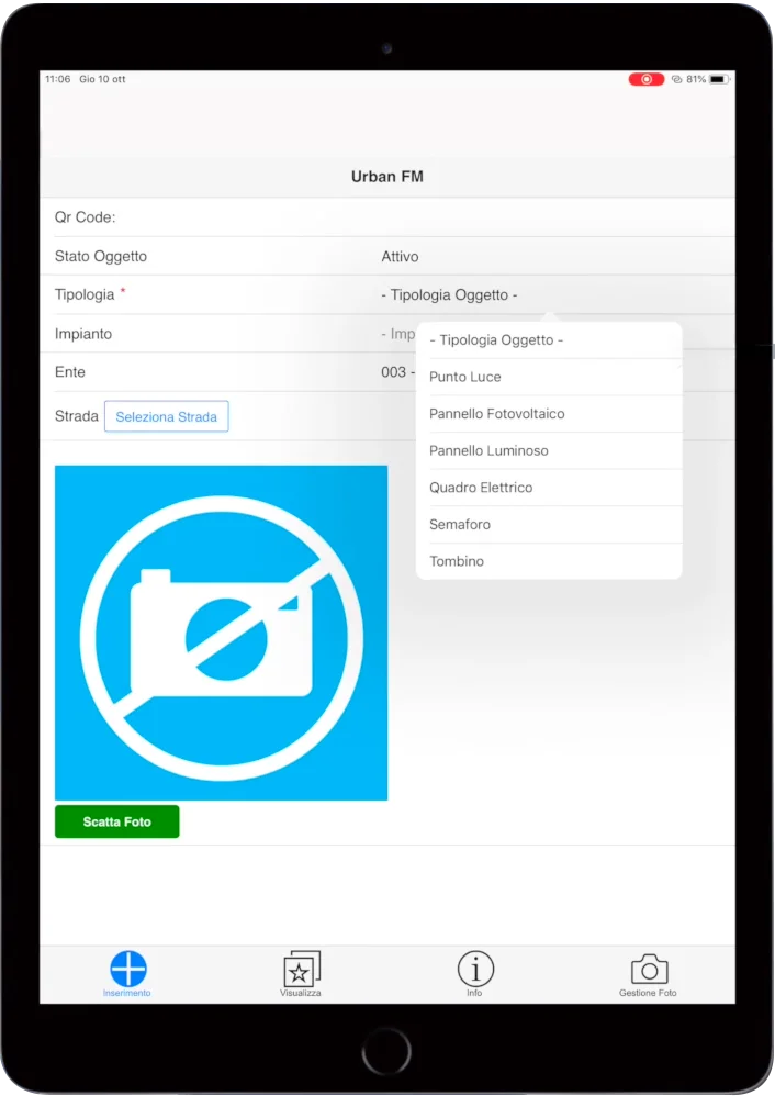
Mobile app for technical teams always updated

Field technicians receive all the necessary information on their smartphone or tablet: assigned tasks, emergencies, materials, location, check-in, photo reports, and minutes. The app allows for a seamless, two-way flow between the field and the control center, with accurate tracking of completed activities.
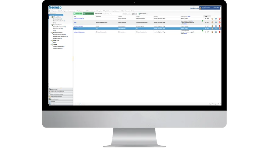
Gestione documenti Geomap

Always up-to-date and verifiable technical documentation

Geomap UFM allows you to associate digital documents with each urban asset (building, system, component), creating an organized and traceable archive.
The document due diligence module allows you to define checklists, monitor deadlines, and report deficiencies with automatic alerts. All documents can be shared, exported, or integrated into other systems.

Consumption monitoring, meters and energy management

The platform integrates tools for recording, analyzing, and accounting energy and water consumption. Data can be entered manually or received from remote monitoring and reading systems. Dashboards and graphs allow you to detect anomalies, optimize costs, and integrate information into ERP systems.
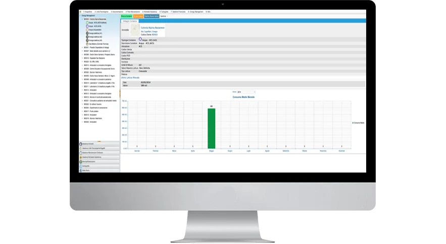
Energy Management Geomap

Consumption monitoring, meters and energy management

The platform integrates tools for recording, analyzing, and accounting energy and water consumption. Data can be entered manually or received from remote monitoring and reading systems. Dashboards and graphs allow you to detect anomalies, optimize costs, and integrate information into ERP systems.
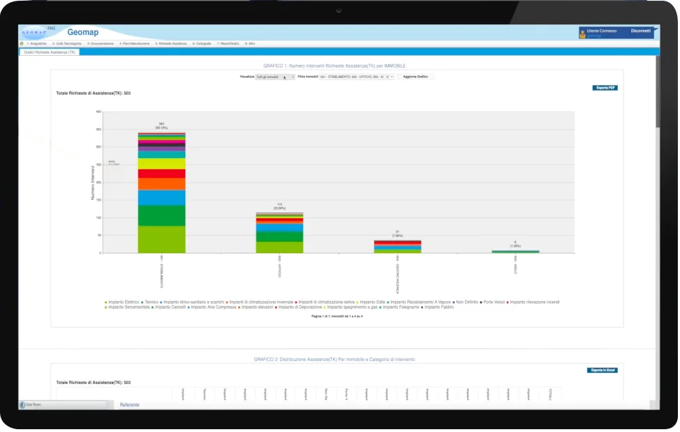
Report Geomap UFM

SLA dashboard, KPIs, and technical performance analysis

All maintenance and management activities are monitored with configurable indicators, such as MTTR, MTBF, and SLA by type or asset.
The system allows you to create customized reports for properties, systems, areas, or cost centers, highlighting efficiency, deviations, and room for improvement with summary graphs and exportable data.

Rated excellent by those who use it every day

With Geomap at your side, you manage the future of your real estate assets

Geomap is certified according to the UNI EN ISO 9001:2015 standard for the provision of:

  • Topographic surveys
  • 3D laser scanner surveys
  • LiDAR aerial photogrammetric surveys with drones
  • Technical registry activities
Certificazione Iso 9001 Geomap
Iso 45001 geomap
Certificazione Pas 24000 geomap
Documented quality, traceable processes, and results that consistently meet expectations, even in the most complex projects.
Rely on a certified, recognized, and excellence-oriented partner.

Services and Support: The Geomap Method

With Geomap, you get a structured solution that accompanies you from initial analysis to operational adoption, with a dedicated team, field surveys, customized configuration, and ongoing support.

T0 - INITIAL AUDIT AND STRATEGIC CONSULTING

The right solution comes from listening and analysis

Each project begins with a direct discussion with the organization or company: we analyze processes, management issues, organizational structure, and regulatory requirements. The goal is to define a clear, coherent, and tailored action plan.

T0 - INITIAL AUDIT AND STRATEGIC CONSULTING

T1 - SYSTEM SURVEY AND ASSET CENSUS

Accurate, up-to-date and usable data from day one

We conduct field surveys to collect and digitize technical and positional information on systems, networks, and infrastructure. Each asset is georeferenced, labeled, and accompanied by personal, photographic, and documentary data.

Discover →
T1 - SYSTEM SURVEY AND ASSET CENSUS

T2 - DATA INPUT AND CUSTOM SETUP

A platform configured to your reality

We import existing data, standardize master data, configure asset types, maintenance plans, user roles, and permissions. The system is built around the client’s operational and technical logic, for immediate effectiveness.

T2 - DATA INPUT AND CUSTOM SETUP

T3 - SYSTEM RELEASE AND GO LIVE

Ready to go with all modules active and verified

Once setup is complete, we deploy the platform to a production environment, with all modules fully functional and tested. The organization can begin using Geomap UFM independently, with validated data and a configured structure.

T3 - SYSTEM RELEASE AND GO LIVE

T4 - TRAINING AND CONTINUOUS SUPPORT

We won’t leave you alone: ​​support and growth over time

We train operational and technical staff, provide practical manuals, and remain available with timely and professional technical support. We support system development with updates, support, and integrations upon request.

T4 - TRAINING AND CONTINUOUS SUPPORT

Our Services to Support Your Growth

Inventario cespiti e riconciliazione contabile Geomap

Asset inventory and accounting reconciliation

Give coherence and value to your business assets

Servizio di rilievo e censimento impianti Geomap

Plant census

Transform any building, facility or urban area into a navigable and measurable digital model

Geomap rilievo laser scanner 3d digital twin

3D Laser Scanner Survey

Create a digital twin of every real estate asset to make more efficient decisions.

Geomap Aerofotogrammetria e rilievo LiDAR con drone

Drone Surveying

Map large areas in high definition and with maximum precision

scan to bim servizio geomap

Scan to BIM

We convert laser surveys into BIM models to design and manage all key information

Geomap Scan to CAD

Scan to CAD

We generate detailed 2D CAD drawings to support design and documentation

For over 25 years, we have supported .

Next steps

Book a free consultation with one of our experts. In 30 minutes, you’ll discover how you can simplify urban area management with Geomap UFM.

    Frequently Asked Questions about Geomap UFM

    Urban Facility Management software like Geomap UFM is a digital platform designed for the integrated management of infrastructure, networks, systems, maintenance, and urban consumption.
    It centralizes information, maps each asset, plans interventions, monitors performance, and optimizes costs in the technical management of the territory.

    With Geomap UFM, you can map and manage public lighting, roads, water and sewer networks, electrical systems, panels, meters, technical buildings, and serviced areas.
    Each asset is described by a georeferenced technical data sheet, linked to documents, activities, and maintenance plans.

    Yes. Geomap UFM includes a mobile web app, designed for operators and field technicians.
    It allows you to receive assigned interventions, consult technical data sheets, update activities, geolocate assets, and complete maintenance in real time, directly from your mobile device.

    Yes. Geomap UFM offers a dedicated technical reporting module that allows you to monitor SLAs, KPIs, MTTR (mean time to repair), MTBF (mean time between failures), and other indicators based on time, geography, or systems.

    Absolutely. The platform is designed to be interoperable. It supports structured data exports (CSV, XML, API) and integration with existing systems such as ERP accounting, CMMS for maintenance, or GIS software via open standards.

    Yes. Geomap UFM has an energy management module that allows you to record, monitor, and analyze energy and water consumption.
    It also supports integration with remote reading systems and can generate useful reports for optimization, reporting, and sustainability.

    Geomap follows a guided process: initial audit, asset survey and inventory, customized configuration, staff training, and release of the ready-to-use platform.
    Activation can be accomplished in just a few steps, even in multi-site environments or with complex organizational structures.

    Yes. The system complies with the digitalization, interoperability, sustainability, and traceability requirements required by public tenders, PNRR, Smart Cities, and European projects.
    It provides structured data, exportable reports, and tools to strategically enhance management activities.