Maintenance and Plant Management Software

Geomap FMS is the cloud-based Facility Management platform for reducing costs, errors, and response times.

End-to-End Solution for Facility and Asset Management

Cloud SaaS, accessible anywhere

The power of AI integrated into the software

Designed to save time, increase control and reduce errors

A single platform Accessible Scalable Traceable

From census to total control: all in one platform

Find out how Geomap FMS supports you in every operational aspect

scheda anagrafica geomap fms

Property, systems, and components records

Organize all technical, operational, and documentary information into intuitive and comprehensive sheets. Each property, system, or component is easily accessible thanks to a hierarchical structure and intelligent search.

Geolocation and interactive floor plans

View each asset on a map or floor plan, and access all the data with just one click. Thanks to the integrated GIS, you can georeference buildings, rooms, systems, and components to plan activities and interventions visually and immediately.
geolocalizzazione e planimetrie interattive geomap fms

Geolocation and interactive floor plans

View each asset on a map or floor plan, and access all the data with just one click. Thanks to the integrated GIS, you can georeference buildings, rooms, systems, and components to plan activities and interventions visually and immediately.
navigazione geomap fms

Hierarchical structure and smart navigation

From real estate to individual components, every level is connected. You can navigate by building, floor, room, or object, ensuring you never miss any useful information.

Quick search and access to information

Instantly find what you need: documents, past work, deadlines, or technical data. The system simplifies daily asset management, even for complex real estate portfolios.
ricerca avanzata geomap fms

Quick search and access to information

Instantly find what you need: documents, past work, deadlines, or technical data. The system simplifies daily asset management, even for complex real estate portfolios.
calendario interattivo manutenzioni geomap fms

Interactive calendar of scheduled maintenance

Easily plan and view interventions using the integrated calendar. You can filter by system, building, or intervention type to always keep track of the status of upcoming activities.

Centralized management of extraordinary requests

Raccogli e gestisci tutte le richieste di assistenza non previste da un’unica dashboard. Il sistema invia notifiche in tempo reale ai tecnici competenti e assegna le attività in modo intelligente.
gestione centralizzata delle richieste geomap fms

Centralized management of extraordinary requests

Collect and manage all unexpected service requests from a single dashboard. The system sends real-time notifications to the appropriate technicians and intelligently assigns tasks.
gestione delle notifiche geomap fms

Automatic notifications and task assignments

Geomap FMS automatically notifies the right technicians based on the type of fault, location, and availability. Every intervention is tracked and documented, reducing errors and response times.

Real-time tracking, reporting and SLA

Monitor every stage of the project: initiation, assignment, execution, and closure. Everything is recorded and analyzed through KPI and SLA reports, ensuring measurable performance and continuous improvement.
tracciamento SLA Geomap FMS

Real-time tracking, reporting and SLA

Monitor every stage of the project: initiation, assignment, execution, and closure. Everything is recorded and analyzed through KPI and SLA reports, ensuring measurable performance and continuous improvement.
gestione documentale geomap fms

Document management and digital due diligence

Easily associate any document (PDF, DWG, Excel) with properties, systems, or components. The system checks for mandatory files, reports deadlines, and generates automatic alerts to prevent oversights or non-compliance.

Customized reports, SLAs, and real-time KPIs

Analyze maintenance performance with clear and customizable reports. Monitor strategic indicators such as SLAs, KPIs, MTBF, and MTTR to improve efficiency and extend system lifecycles.
report e kpi Geomap fms

Customized reports, SLAs, and real-time KPIs

Analyze maintenance performance with clear and customizable reports. Monitor strategic indicators such as SLAs, KPIs, MTBF, and MTTR to improve efficiency and extend system lifecycles.
energy management geomap fms

Consumption Monitoring and Energy Management

Monitor energy consumption in real time and optimize costs and sustainability. The system integrates with remote reading devices and generates comprehensive dashboards for controlling and accounting consumption.

Management dashboard for analysis and decision-making

A single dashboard to view property status, service flow, technical team performance, and anomalies. Everything under control, in real time.
dashboard geomap fms

Management dashboard for analysis and decision-making

A single dashboard to view property status, service flow, technical team performance, and anomalies. Everything under control, in real time.

Rated excellent by those who use it every day

Con Geomap al tuo fianco, governi il futuro del tuo patrimonio immobiliare

"With Geomap FMS, we finally have a digital map of all our buildings. The system has allowed us to drastically reduce intervention times and improve maintenance traceability."
Facility Manager,
Energy Industrial Group

Services and Support: The Geomap Method

From the first meeting to Go Live: we’ll guide you step by step towards operational efficiency.

T0 - INITIAL AUDIT AND STRATEGIC CONSULTING

Understanding before acting: our work starts with an analysis of your reality.

We gather information on properties, systems, processes, and critical issues. We define objectives, priorities, and required customizations. We provide clear guidance on the implementation roadmap.

T0 - INITIAL AUDIT AND STRATEGIC CONSULTING

T1 - SURVEY AND CENSUS OF PLANTATIONS

We build the foundations: we digitize your assets in 2D, 3D, and BIM.

Technical survey of buildings and systems. Complete inventory to compile the technical records of properties and components. Instant integration with the Geomap FMS information system.

T1 - SURVEY AND CENSUS OF PLANTATIONS

T2 - INFORMATION SYSTEM SETUP

We configure the system according to your operational and organizational needs.

Customize user profiles, processes, and roles. Data import, maintenance plan creation, and document management. Operational training for your employees.

T2 - INFORMATION SYSTEM SETUP

T3 - CUSTOMIZED GO LIVE

Get off to a good start: we only go live when everything is ready.

Customized system activation and final testing. Support during operational start-up. Post-activation monitoring and support for a smooth start-up.

T3 - CUSTOMIZED GO LIVE

GEOMAP FMS MOBILE WEB APP

An ally always in your pocket for your technicians

With the Geomap FMS Web App, your team is always connected, efficient and informed.

kpi facility management

Accessible from smartphones and tablets

Complete Management of Field Interventions

Automatic real-time notifications

Cards, documents and maps always available

The Benefits for Your Team

  • Faster and more precise interventions

  • Removing barriers between the office and the field

  • Reducing response times and errors

  • More control for the Facility Manager, less stress for technicians

For over 25 years, we have supported .

Next steps

Book a free consultation with one of our experts. In 30 minutes, you’ll discover how you can streamline your business with Geomap FMS.

    Our Services to Support Your Growth

    Inventario cespiti e riconciliazione contabile Geomap

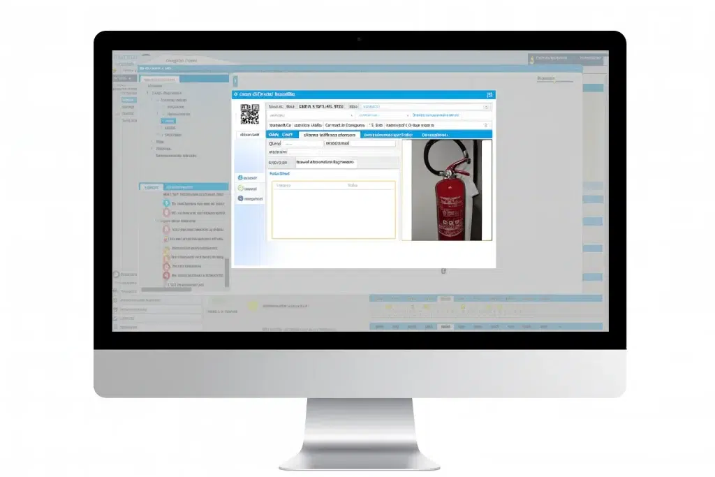
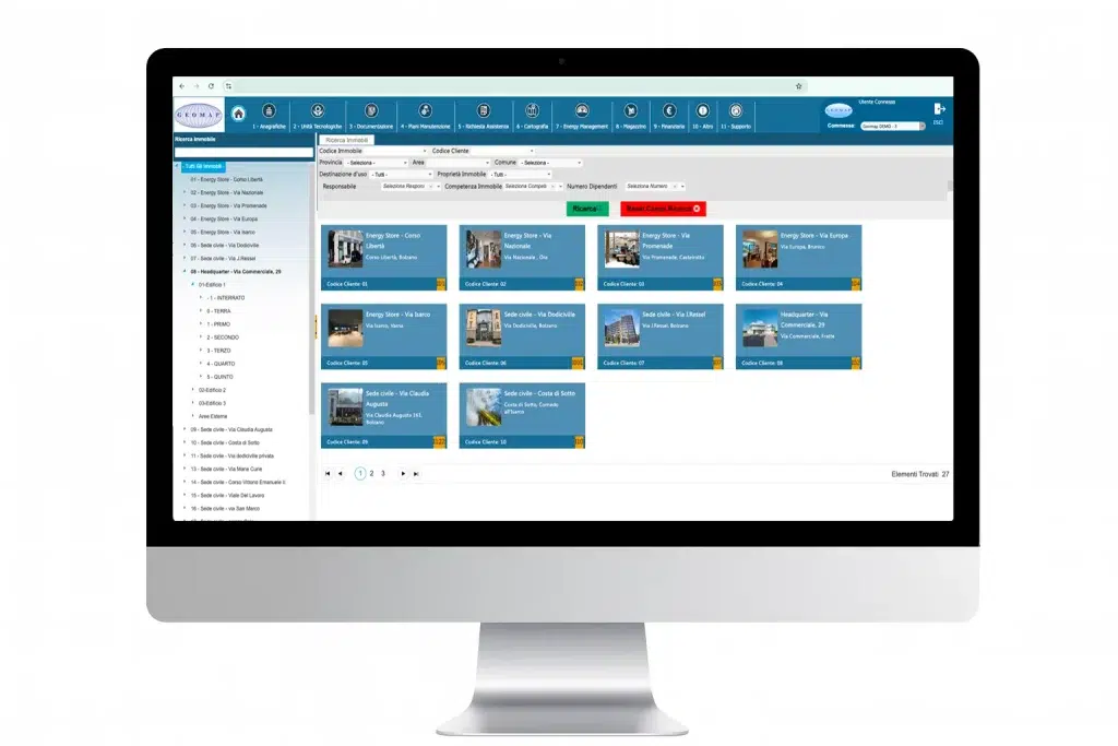
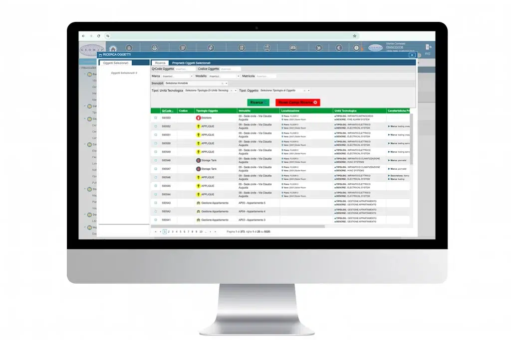
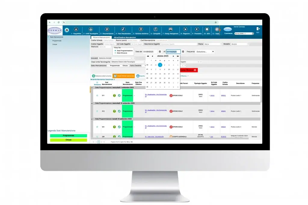
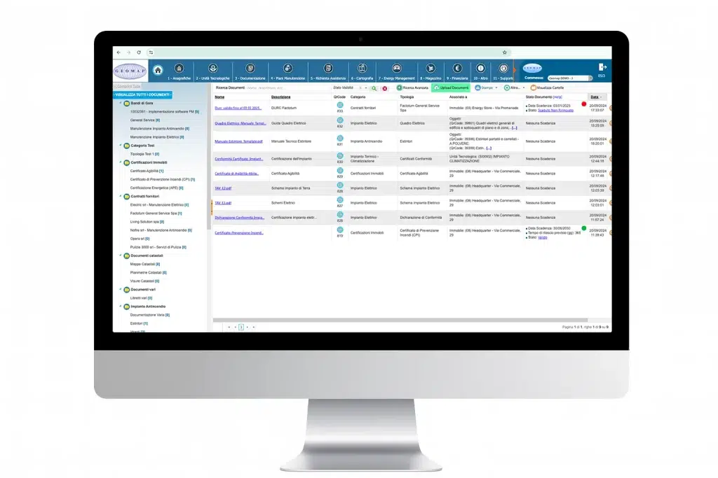
    Asset inventory and accounting reconciliation

    Give coherence and value to your business assets
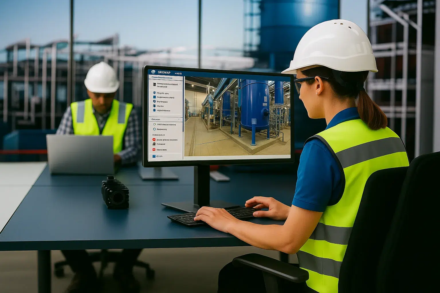
    Servizio di rilievo e censimento impianti Geomap

    Plant census

    Transform any building, facility or urban area into a navigable and measurable digital model

    Geomap rilievo laser scanner 3d digital twin

    3D Laser Scanner Survey

    Create a digital twin of every real estate asset to make more efficient decisions.
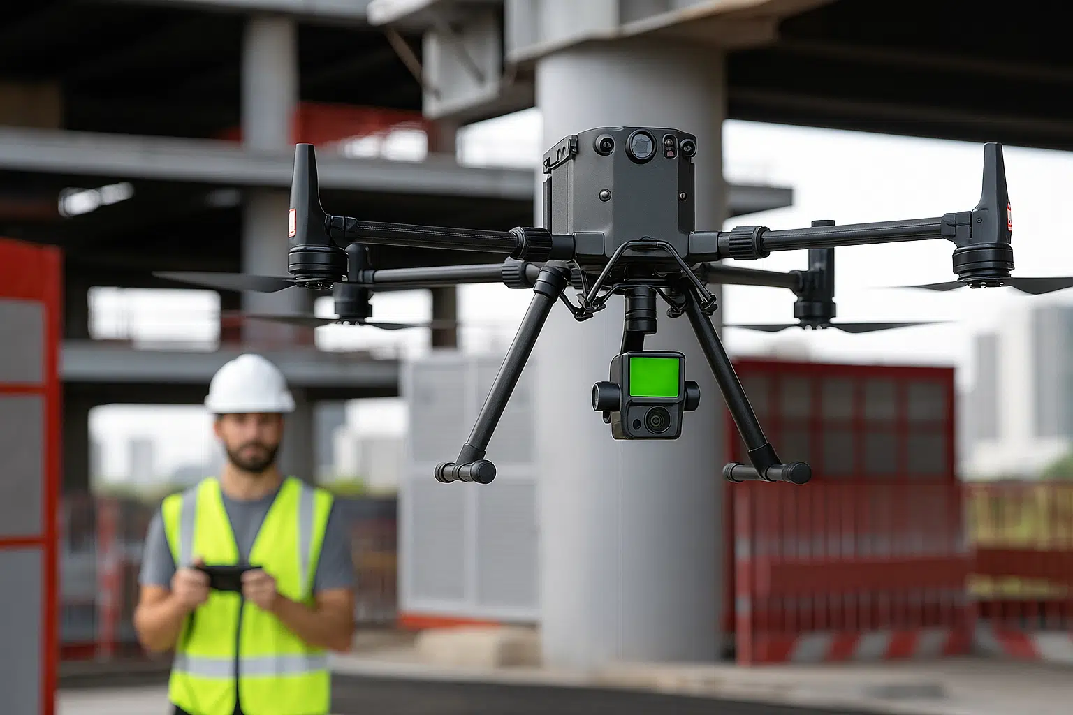
    Geomap Aerofotogrammetria e rilievo LiDAR con drone

    Drone Surveying

    Map large areas in high definition and with maximum precision

    scan to bim servizio geomap

    Scan to BIM

    We convert laser surveys into BIM models to design and manage all key information

    Geomap Scan to CAD

    Scan to CAD

    We generate detailed 2D CAD drawings to support design and documentation

    Frequently Asked Questions about Geomap FMS

    Absolutely.
    Our team supports you from the very first step: physical survey, census, digitization, and creation of initial records. You don't need to start with a digital version: we'll take care of it.

    It depends on the complexity of your assets.
    Thanks to our 4-step method (Audit, Census, Setup, Go Live), we can guarantee rapid, progressive, and personalized activation.

    Yes.
    With the Geomap FMS Web App, your technicians can work directly from their smartphone or tablet, even offline, with all their information and activities always up to date.

    Yes, through APIs and custom configurations.
    We can interface with management software, remote reading systems, technical accounting, or platforms already in use by your company.

    Yes, you can schedule a free call with one of our experts.
    During the first meeting, we'll show you the main features and how we can adapt Geomap FMS to your specific needs.

    Yes, Geomap FMS is designed to scale.
    You can manage real estate assets spread across multiple locations from a single platform, with centralized visibility and localized management. Each site maintains its own records, documents, and processes, but control remains unified.